
Westcountry Rivers Trust The River Taw rises high on the slopes of Dartmoor and together with its tributaries, the River Mole, Yeo and little Dart, runs north through beautiful rolling countryside down to Barnstaple and into the Bristol Channel.
At 45 miles long, the Taw is one of the larger Devon rivers. The Taw provides habitat for a wide range of animals and plants alike, resulting in many stretches of the river being protected as Sites of Special Scientific Interest (SSSI). The Taw estuary which forms part of the UNESCO Biosphere reserve is a fantastic place to spend the day watching the many different types of wading birds that can be found there. The number of wading birds, including lapwings, curlews and redshanks, can reach over 20 000!
https://wrt.org.uk/project/river-taw/
- Hits: 1422
Exmoor was designated as a National Park in 1954. Since then, the co-ordination of work to achieve National Park purposes in the area has been undertaken by local government and since 1997 by a free standing Exmoor National Park Authority.
Exmoor National Park Authority decides what measures to take to achieve the two National Park purposes;
"To conserve and enhance the natural beauty, wildlife and cultural heritage of the National Park"
"To promote opportunities for the understanding and enjoyment of the special qualities of the National Park by the public"
In carrying out these purposes the Authority has a duty to seek to foster the economic and social well-being of local communities within the national parks
All planning applications within the National Park area are determined by the National Park Authority and applications are dealt with at our offices in Dulverton. Planning policies are there to ensure both rural prosperity and the protection and enhancement of the special character of Exmoor.
https://www.exmoor-nationalpark.gov.uk/
Social Media:
Facebook: https://www.facebook.com/ExmoorNP (13.7k)
Twitter: https://twitter.com/exmoornp (12.1k)
Pinterest: https://www.pinterest.com/ExmoorNP (136)
YouTube: https://www.youtube.com/channel/UCgUgh9Nu0z80VPO961Z-9tQ (306)
Instagram: https://instagram.com/exmoor_national_park/ (4.4k)
Flickr: https://www.flickr.com/photos/exmoornp/albums (46)
- Hits: 1287
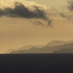
This is a landscape of contrasts, dominated by its seascape. There are wide westerly views to the sea, with the long, low outline of Lundy visible on the horizon, and views across Bideford Bay as far as Hartland Point. A series of rolling downland ridges run on to long headlands interspersed with sandy beaches. The smooth downland has an elevated, open, character, whilst the rough headlands feel wild, remote and windswept. The beaches are crowded with holidaymakers in summer, but in winter they feel empty and desolate. This is a colourful landscape – green fields; golden sands; vivid purple and yellow heath; brown and grey rocks; and glorious sunsets – but its mood is always set by the ever-changing sea.
This is a fairly small area comprising the westward-facing coast between Saunton Down and Morte Point. To the north is a gradual transition to the North Devon High Coast (where the downland landform is less dominant and there is more woodland) and to the east is another gradual transition to the North Devon Downs. This transition is marked by a gradual reduction in the influence of the sea. To the south is the flat, estuarine landscape of the Taw-Torridge Estuary.
https://www.devon.gov.uk/planning/north-devon-area/north-devon-coastal-downs
https://www.devon.gov.uk/planning/planning-policies/landscape/devon-character-areas
- Hits: 1055
This is a simple, agricultural landscape dominated by the sky within an open, westerly aspect. The smooth hills have rounded profiles, and are covered by a patchwork of large, regular fields. Views are long and wide, sometimes with glimpses of the sea or estuary as a backdrop. The steep valleys which punctuate the downland run like wooded ribbons across the landscape, contrasting with the farmland in their rich colours and textures. These valleys have a secluded and secretive character. They are very tranquil, the only sounds often being birds and running water; and their sunken lanes have a timeless quality.
This area is located to the north of Barnstaple and comprises high open farmland interspersed with secluded wooded valleys. To the north is the North Devon High Coast with its coastal combes; to the east a gradual transition to the wooded, intricate landscapes of the Exmoor Fringe; to the south a gradual transition to the Codden Hill and Wooded Estates and also a more abrupt transition (marked by the change in topography) with the Taw-Torridge Estuary. To the west is a gradual transition (with increasing coastal influence) to the North Devon Coastal Downs.
https://www.devon.gov.uk/planning/north-devon-area/north-devon-downs
https://www.devon.gov.uk/planning/planning-policies/landscape/devon-character-areas
- Hits: 1222
This landscape of rolling, interlocking ridges, deeply incised by river valleys and patterned by beech hedges, provides an important setting and transition to Exmoor. The upland river valleys drain southwards from the high moorland, forming deep clefts in the landscape that contain clean, fast-flowing water and are clothed in ancient oak woodlands. The Bray valley is the major landscape feature of the western part of the area; further east the valleys are shorter, steeper and narrower. Tree features and hilltop clumps form notable landmarks. The area is sparsely settled, with individual farmsteads and small hamlets and vernacular buildings that are mainly of sandstone and slate. Seen from the south, the area forms the foreground landscape to Exmoor. Seen from the north it forms a diverse and strongly patterned patchwork of fields and wooded valleys.
This area abuts the southern and western boundaries of Exmoor National Park (not part of the Devon Landscape Character Assessment). Bounded to the west by the more open landscape of the North Devon Downs and to the south by the South Molton Farmlands and Witheridge and Rackenford Moor, this area of enclosed pastoral land with deep north-south wooded valleys rises northwards to the Exmoor moorland rim, where there is a clear landscape transition.
https://www.devon.gov.uk/planning/north-devon-area/exmoor-fringe
https://www.devon.gov.uk/planning/planning-policies/landscape/devon-character-areas
- Hits: 1121
An open, elevated landscape, where the long views out make an important contribution to the sense of place. The high land of Exmoor (to the north) and Dartmoor (to the south) provide orientation, and a backdrop of seasonally-changing colour. In the north, views out to sea and across the north Devon coast lend a strong maritime influence. Views across and into the neighbouring Taw and Torridge valleys emphasise the contrast between this open farmland and the wooded, enclosed and intimate valley landscapes on either side. Skylines are very important, with clumps of trees and square church towers acting as prominent features and landscape focal points. Woodland and occasional patches of unimproved grassland contribute to the seasonally-changing colour and texture of the landscape.
This long, narrow area comprises the ridges of high land between the Taw Valley (to the east) and the Torridge Valley (to the west). To the north is the lower-lying Taw-Torridge Estuary, and to the south is a gradual transition to the open inland plateau of the High Taw Farmland.
https://www.devon.gov.uk/planning/torridge-area/high-culm-ridges
https://www.devon.gov.uk/planning/planning-policies/landscape/devon-character-areas
- Hits: 2119
A landscape distinguished by its landform of high, whale-backed hills, and the presence of large estates of woodland and parkland. There is a strong sense of peace and tranquillity in the woodlands and along the winding, hedge-banked lanes, with a feeling of being at the ‘heart of Devon’. This is a managed, working landscape with a strong sense of history and culture, with many historic parkland features still visible in today’s landscape. Estate villages cluster around stone bridges or crossroads, and farms nestle into folds in the hills.
This area, centred on the small market town of South Molton south-east of Barnstaple, comprises a well-wooded landscape with strong parkland influences. To the north and east are gradual transitions to the North Devon Downs and the South Molton Farmlands respectively. The lower land of the Taw Valley wraps around the southern and western parts of the area.
https://www.devon.gov.uk/planning/north-devon-area/codden-hill-and-wooded-estates
https://www.devon.gov.uk/planning/planning-policies/landscape/devon-character-areas
- Hits: 2097
Bright green fields divided by thick dark green hedgerows create a strong patchwork pattern across this peaceful and highly rural landscape. Steep, narrow and ancient lanes and tracks wind across the hills between flower-rich banks and luxuriant hedgerows. South Molton is a thriving market town with a wealth of colourful medieval, Elizabethan and Georgian buildings laid out around its busy main square. The square towers of the churches of South Molton, George Nympton and Bishop’s Nympton are glimpsed between the hills and form important local landmarks.
This is a relatively small area, comprising land around the small market town of South Molton, plus the valley of the River Yeo extending eastwards. To the north is a gradual transition to the ridges and wooded valleys of the Exmoor Fringe. To the south is a gradual transition to the lower land of the Taw Valley, with Witheridge and Rackenford Moor beyond and to the east. To the west is the Codden Hill and Wooded Estates, the transition being marked by the edge of the Castle Hill estate.
https://www.devon.gov.uk/planning/north-devon-area/south-molton-farmland
https://www.devon.gov.uk/planning/planning-policies/landscape/devon-character-areas
- Hits: 2161
Exmoor National Character Area (NCA) is predominantly a landscape of upland plateaux of Devonian sandstones and slates terminating in the north at the Bristol Channel with a spectacular cliff coastline. It lies across the counties of Devon and Somerset. The Devonian geological time period was first described and recorded in association with this area. To the west the area terminates at Barnstaple/Bideford Bay and the Taw and Torridge Estuary and to the east at the Vale of Taunton Deane. The Exmoor area contains sparse settlement with centres at Braunton, Ilfracombe, Lynton and the western edges of Minehead, all associated with the coast, and inland at Barnstaple, Dunster, Dulverton and Bampton.
http://publications.naturalengland.org.uk/publication/2303045?category=587130
- Hits: 1169
Devon Birds took over the area surrounding the Velator SWW former sewage treatment site when it was converted into an automated pumping station in 1998. It is only suitable as a ‘closed’ reserve, so no general access, but members are welcome by appointment.
The area was landscaped and extensively planted with a variety of native trees – mostly Willow, but good numbers of Alder, Oak and Ash, some Elder, with Guelder Rose, Sea Buckthorn and Hawthorn providing the berry crop – these have been nurtured over the succeeding years, so that there is now extensive tree cover. This took a long time as the growth of Charlock was difficult to keep down! Also the landscaping was completed with immense amounts building rubble, with very little topsoil in many places.
https://www.devonbirds.org/birdwatching/places_to_go/velator
Devon Birds sightings at Velator
- Hits: 1118


